用來產生Tile Number,格式可自己調整
https://chart.apis.google.com/chart?chst=d_text_outline&chs=256x256&chf=bg,s,00000044&chld=FFFFFF|32|h|000000|b|||x={x}|y={y}|z={z}||||______________
不過Mapzen已死,有事燒紙...
https://tile.mapzen.com/mapzen/vector/v1/{all/building/earth,landuse}/{z}/{x}/{y}.{mvt/topojson/json/vtm}?api_key=mapzen-Ka4PVaQ
由Rex的Server提供的魯地圖
http://rudy.tile.basecamp.tw/{z}/{x}/{y}.png

地圖產生器提供的航跡檔
http://rs.happyman.idv.tw/map/gpxtrack/{z}/{x}/{y}.png

地圖產生器提供的等高線圖(魯地圖vanilla)
htps://rs.happyman.idv.tw/map/moi_osm/{z}/{x}/{y}.png

OpenStreetMap 經典圖磚
http://{a|b|c}.tile.openstreetmap.org/{z}/{x}/{y}.png

http://maps.nlsc.gov.tw/OpenData/wmts
預設圖層:解析度和style爛到有剩...
http://wmts.nlsc.gov.tw/wmts/EMAP5_OPENDATA/default/GoogleMapsCompatible/{z}/{y}/{x}
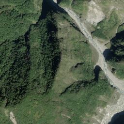
正射影像圖:高解析度的影像
http://wmts.nlsc.gov.tw/wmts/PHOTO2/default/GoogleMapsCompatible/{z}/{y}/{x}
正射影像圖with等高線
http://wmts.nlsc.gov.tw/wmts/PHOTO_MIX/default/GoogleMapsCompatible/{z}/{y}/{x}
https://ecn.t2.tiles.virtualearth.net/tiles/a{quadkey}.jpeg?g=587&mkt=en-gb&n=z


先加入一些想到的圖資